Thursday, December 27, 2007

Skagit Lowlands


When the persistent storms of winter darken the sky and provide only momentary respites from the wind and rain; experienced club members know that it’s the perfect time to explore or revisit the lowlands of Western Washington. During the course of a few weeks a series of Short-Notice-Outings of the Mt Baker Club provided opportunities for enjoying nature while dodging the worst of the weather. These outings included hikes, walks, and nature observation over a fascinating selection of sites.

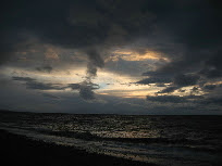
Some of the highlights were: the summit bushwhack (reported trails were non-existent) of Bow Hill and the new trail construction at the north section of Deception Pass State Park; another trip to explore the Tommy Thompson & other trails near Anacortes with a short geology fieldtrip down the Chuckanut Coast and Padilla Bay; sunset beach walks with glorious golden light escaping under the dark clouds; while further up the Skagit Valley we explored the Northern State Recreation Area with it’s extensive trails and historic structures; walks along the Skagit provided examination of various bygone ferry crossings that now make excellent paddle put-ins; another day we drove with numerous stops and hikes down Friday Creek (Squires Lake included) and then up the Samish River to the high ground of Saxon Cemetery; gushing waterfalls, abandoned mines, ghost towns, flooded roadways, unique mountain viewpoints, and the massing of the Nooksack Elk herd gave us many vivid memories; the occasional shower seemed a small price to pay.

Monday, December 3, 2007

Chilliwack Valley and Hope Explorations


With a break in the cloudy weather a group of us headed up the Chilliwack Valley to explore new sites and check conditions at familiar ones. We drove on snowcovered road to the gated Chilliwack Lake Provincial Park. From there we snowshoed through the forest and trails to the new bridge over the Chilliwack River. A pleasant morning of touring brought us to the new connection to the Radium Lake trail. One of the highlights of the morning included the fresh bear tracks leading through the otherwise vacant campground. None of us had expected this. On the way out we stopped at numerous trailheads discussing our plans for future trips.

Continuing up the Fraser Valley we arrived at the obscure Dog Mt trailhead. A surprisingly beautiful old-growth forest was our afternoon reward for visiting this little known trail. Obviously constructed for extreme mountain bikers we marveled at the size and difficulty of the obstacles and near vertical descent of the course. By late afternoon we were still able to see the summit of Hope Mt, clearly visible across the Fraser River. It was a wonderful outing resulting in plans for many return trips. A pleasant dinner in Hope rounded out an exceptionally enjoyable day.

Wednesday, November 28, 2007

Mt Baker Club, Short Notice Outings, Fall 2007


Despite the rollercoaster fall weather of sun, rain, cloud, fog, ice, snow, and potential flooding;
members of the Mt Baker Club expertly matched conditions to outings for many memorable trips as the winter haltingly approached. Here is a sampling of these outings; several of which are
no longer possible until the spring (or summer) thaw.

Mt Loop Highway Adventures
The announcement of the opening of the Mt Loop Hwy after four years of closure provided an easy excuse for several trips to this area. For the past several years, club members had “nibbled” away at the broken ends of the Mt Loop via hikes and bike rides. Early in the season hikes to high mountain passes and picturesque lakes were still possible. With the arrival of snow and ice, shorter hikes and snowshoe trips were made beautiful by the freshly fallen snow. As always, we enjoyed a wide assortment of sights including dramatic summit views, raging river cataracts, pounding waterfalls, and fascinating historic sites.

Serpentine Lake, Coquihalla, BC
A long desired hike to a remote mountain lake, famed for the encircling outcrops of serpentine rock. Despite overcast weather we made our way up steeply through some of the most fascinating old-growth forest any of us had ever seen. Encroaching logging had not yet reached these slopes, allowing us to enjoy a cross country trek through a green carpeted forest characterized by a wide and wild assortment of tree species, sizes and ages. After enjoying the tranquil lake setting we intersected the rough trail and followed it down thus giving us a wonderful loop experience. Evidence of on-going logging up slope made us feel even more blessed to have experienced this wonderful area. On the drive back we visited various trailheads, interpretive sites, abandoned rail lines and other locations in this fascinating canyon with exciting plans for future trips. An excellent dinner in Hope provided a comfortable end to a memorable day.

Stimpson Reserve, Sudden Valley
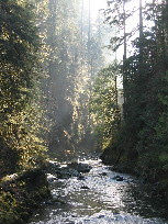
An annual Club event, a sizeable group of members joined Janet for an enjoyable hike through this natural area. Warm wintery sunlight, attractively streaked through the forest framing surprisingly large trees and attractive wetlands and lakes. It was interesting, hiking from the new access trail and learning about other trail construction in the area. Afterwards we returned to Janet’s house for a wonderful selection of hot soups which gave us one of those rare opportunities to enjoy each others company indoors. Leaving, we all felt the warmth of not only the delicious soup but the good fellowship that we had shared. Many thanks to Janet for once again putting this outing together and opening her lovely home to all of us.

Returning to our customary meeting place at the Sunnyland School parking lot on this Memorial Day weekend, a group of us paid our respects at Memorial Park just down the street. The large trees lining the park had been planted in dedication fallen soldiers of the World War (I). A new memorial, sadly with vacant space still being filled, marks the names of more fallen soldiers from the wars that have since followed.

Mt Baker Highway Explorations
In our own backyard, we had several trips this fall to find and explore historic mines and trails. We enjoyed a wealth of experiences including: abandoned gold mines, culturally modified trees, historic and lost trails, waterfalls, wild goats & elk, and incredible mountain scenery. The highlight of our trips was undoubtedly our rediscovery of the original Mt Baker Trail which led to the club’s former Kulshan Cabin now just a location on the modern Heliotrope Trail. This trail was also used by some of the racers in the Mt Baker Marathon. Now with the snow covering the ground we eagerly wait for the summer to find the extent of the remaining portions of this abandoned but historically important trail.

Lynn Cedar, North Shore, Vancouver
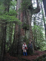
A long awaited quest to find the 1,000 year old cedar of Lynn Canyon was successful for a group of club members this fall. A cloudy marginal day was perfect for the forest hike following sketchy directions to this magnificent tree. Picking our way along by way of abandoned trails, occasional steep slopes augmented by dubious ropes we felt some sense of accomplishment. Lunching on the banks of the Lynn River gave us more time to absorb the beauty and surprising wildness of our surroundings before returning to the urban setting of Vancouver. Not wanting to waste even this, we completed another long overdue goal of having dinner at the ethnically accurate Afghan Horsemen.

North Cascades Hwy
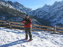
Camping in a vineyard, crunching ice on the hike to high mountain passes, skiing and snowshoeing at Washington Pass and Rainy Lake, all added to several days of fun in exploring a familiar area relatively close to home. Every year club members try to experience that last perfect blue sky outing before the fall storms close the pass for the remainder of the season. We’re not lucky all the time but this year we judged it perfectly, twice. Cold, powder dry snow, views of Liberty Bell and surrounding peaks from the snowcovered overlook, big open meadows, and lakes trapped in tight and vertical walled cirques were all blanketed by a cloudless and perfectly blue sky.

Southern Olympics
With marginal weather and the closure of Staircase and other forest access points we still managed to fill our days with exploring abandoned mountain railtrails, thundering remote waterfalls, and magnificent old growth forests in this proverbially wet area of the state. Lowering clouds encouraged us to visit waterside parks and historic sites along the south end of the Hood Canal. This was an enjoyable trip and one of those unusual times when everyone was willing and pleased to dry out in a motel and enjoy a hot dinner indoors.

Hwy 2 Snow Exploring
With the advent of low elevation snow we set off along Hwy 2 to sample and check conditions for numerous winter outings. The morning was spent snow hiking the old growth forest near Lake Elizabeth. Later we explored the conditions of the North Fork Skykomish and Beckler River drainages. We ended the day with a ski tour in the big tree area of the Smithbrook Rd just east of Stevens Pass. We came away with plenty of ideas for snowshoe and ski tour trips this winter.

Samish River Paddle
One of the few ways to actually enjoy the rainy fall weather is with a kayak paddle. Responding to a call for a mountain hike, an assortment of intrepid paddlers took their cue from stormy conditions to meet and explore the Samish River drainage instead. Beaver signs, animal slides, eagles, salmon and a sinuous route provided us with plenty of interest. The short but intense paddle against the current of the upper river was prematurely ended by a small but definitive log jamb. It was a good place to turn around and enjoy the free ride down current until meeting the rising tide. The predicted heavy rains and wind didn’t reach us until we were safely at home that night. What a break.

Sunday, October 21, 2007

Fall Outing: KVR Railtrail, BC

Thanks to the old Short Notice Signup List members of the Mt Baker Club were able to form a fall outing to explore the KVR (Kettle Valley Railtrail) in the Tulameen Valley, northwest of Princeton, BC. This is one of the three most fascinating sections of the trail in our area and possibly in the nearly 1000 km trail.

The weather cleared beyond Manning Park and the fall colors were vibrant and golden. Eventually, the entire group settled at the riverside Granite City Rec Area, adjacent to the gold mining ghost town of Granite City. From here we could bike the short distance to Coalmont and ride the trail either north to Otter Lake or south towards Princeton.

Riding north the first day was a sunny trip along the entire length of Otter Lake into the ranchland stretching all the way to Merritt. One memorable event occurred during this ride. We were just rounding a bend in the trail when suddenly a group of young cyclist (later we learned that they were from Vancouver) frantically biked past us shouting “Bear! Bear! There’s a Bear on the trail!” One of our members bravely (some might say foolishly) slowly and noisily biked ahead. There, at a mere 300 yards distance, was a huge black bear apparently sleeping in the middle of the trail. Cautiously he approached and with a loud shout drove the beast from the trail. The only response was a bellowing Moooo as the “Bear” wandered off to join the rest of the herd under the trees. This made interesting conversation at the Coalmont Hotel & Pub afterward and around our cozy campfire that evening.

The next day dawned brilliant. The morning light lit up our camp through the canopy of golden cottonwood and aspen leaves. The blue sky welcomed us as we cycled south. The canyon quickly narrowed but due to the frequent north-south orientation, provided us with warm sunlight for nearly the entire day.
Passing quiet river pools, beaches, and pleasant picnic sites we eventually reached the tunnel and copula viewpoint.
Here the river became a raging flow as it sped around the bend and through great boulders which had forced the construction of the tunnel. As if to emphasize the drama of this place, a yellow canoe could be seen, impaled on the rocks below us.


From here the group separated, some returning, while others continued past rocky outcrops, hoodoo formations, and the famous (soon to be designated a World Heritage Site) vermillion cliffs. The final section of trail sped through a lighted tunnel and into downtown Princeton. A fine day was had by all.


The next day, the group disbanded with various plans for the drive home: exploring more ghost towns, searching for pictographs, visiting historic cemeteries, and enjoying the many viewpoints and short hikes along the way. We all felt that we wanted a return trip next year.

Fall Outing: Yakima Valley

Inspired by the wonderful article in the Wash. Trails Assoc magazine (April 2007 Hiking Wine Country) and motivated by the damp, dark fall weather in Western Washington, we headed east for a few days of drier conditions. We were not disappointed. The fall colors were at their peak, and locals claimed they were exceptional this year.

A wonderful variety of short outings were ours to enjoy including: hiking old favorites like Cowiche, Umtanum and Black Canyons; visiting new ones like Selah Butte, Horse Heaven Hills, Snow Mountain Ranch, Badger Mt; and exploring fascinating geologic features of volcanic flows and glacial floods. For variety we also managed some cultural explorations including Ahtanum Mission, the murals of Toppenish, the famous vineyard & hop industry of the Yakima Valley, and some delightful restaurants.

Some other highlights included a short visit to Roslyn. This picturesque little town was the outdoor film location for “Northern Exposure,” but is also the center of a short but fascinating Mine Rail trail.
The drive and hikes down Yakima Canyon were beautiful though the big-horned sheep had not yet moved to the canyon walls, part of their wintering range. On the way home we decided to drive through the eastern part of Mt. Rainier NP. Of course we returned to the rain but the views along the American River were beautiful and our passage over Chinook Pass was poignant as we realized that snow would soon be closing it.


This was a wonderful fall trip, one that gave us more ideas for the future; maybe a short notice outing next year? Thanks again to our friends at the WTA (http://www.wta.org/), we look forward to sharing the trail with you again.

Friday, October 5, 2007

Steveston, BC, Year-Round Destination

Photos: http://www.mountbakerclub.org/StevestonBC
Thanks to the Mt Baker Club Short-Notice Outings list-serve; a group of us shared a uniquely different mid-week outing. It was a short drive and border crossing bringing us to our first stop of the morning; an amazing Buddhist Temple. Incredible use of gold-leaf; brilliantly painted architecture, and carefully constructed gardens were a delight, encouraging us to begin the day in a relaxed and reflective mood.

Minutes and a world away: We explored Finn Slough, the historic home of fishermen, houseboats, and waterside shacks. Little changed; small boats tied up, precarious little docks perched above the swirling slough waters; charming gated garden entrances. A brief stop at the New London Farm; clean, cute, Victorian, its primness made an interesting counterpoint.

Onto the historic and charming downtown of Steveston with a light snack from Pajo’s Fish & Chips at Garry Point Park. Strolls along the waterfront, wetlands, waterfowl, historic cannery, boat shops, and homes, highlighting the rich and varied heritage of the area.

The rest of the day we entertained ourselves with walking through the compact downtown. Some tourist oriented shops, but well supported by locals giving Steveston a more “real” feel than one might expect. Highlights were the Japanese and Community Cultural Center and, the newly established but wonderfully rustic Romanian Bakery with its welcomed warmth from the wood fired oven (the loaves were exceptionally delicious but huge; make sure you’ve either got a very hungry group or a strong rack on your bike).

Throughout the afternoon the weather constantly changed from beautiful warmth and calm; to dark, grey, wind, and rain. Somehow we were always in a bakery or coffee shop when it rained and were always pleasantly surprised that it was nice again when we were ready to continue our walk.

Towards evening we wandered into an unexpected event. CTV news was doing their community focus program with the evening news filmed at a different community each evening. By wonderful coincidence it was being filmed on the Steveston boardwalk this day. We were given lots of little mementos (key chains, brochures, mini-thermometers, 2010 Olympic pins, etc.) and treated to the Kyoto Drums a reflection of the strong Japanese heritage of Steveston. The news anchors were very nice and between their on-air presentations, they would tirelessly pose for photos with local people including their pets.

As daylight faded into evening we found a window table at Le Nakamura restaurant for an excellent Japanese dinner. Afterward it was a short walk around the block to the Cultural Center where we were allowed to watch a Kendo class in its entirety. The participants ranging from old to young and beginner to advanced made a thrilling display of practice and training bouts with this Japanese form of sword fencing.

An easy drive and again an empty border crossing (going south) brought us home without incident. We all came away from this trip delighted and eager to return to enjoy the many hiking, biking, and cultural experiences that this nearby community has to offer.

Saturday, September 29, 2007

Alaska: Final Entry

I made my way back to Juneau with a hop over the mountains in a light aircraft, the same one stuffed with spruce buds for making winter ale at the local brewery. The big choice facing me was; to use a free ticket for a one-day flight home or, take the slow boat to Bellingham. I was quite surprised at the overpowering feeling of the “rightness” in returning by ferry.

A couple more days of poking around Juneau and all too soon I was heading south for the last and longest ferry ride of the trip. The evening light slowly descended but not without giving me extraordinary views at glaciers calving, sending their young bergs down into the waterways. Later, this same night, we saw great tail flukes of diving whales just off our starboard side. Silhouetted against the star light and ocean phosphorescence, it was a remarkable sight.

I had opted to sleep on deck, much braver now, or at least familiar with ferry camping. They were the best nights that I spent on the entire trip. Invisible warmth from infrared heating, open views to the islands, sea and sky, cool evening breezes. Some of the stops required brief middle of the night dockings, It was surreal to see these now familiar ports again but cloaked in darkness with only splashes of light from the dock lamps.

The rhythm of the trip was steady but slow, second chances to see mountains and passages, more time to meet interesting passengers and crew. I invited the US Forest Service Ranger stationed on the ferry to join the Mt Baker Club for a hike during their 8 hour lay-over in Bellingham. (Which he later did. We showed him the great views from Oyster Dome and enjoyed hearing about the hiking in SE Alaska).

Possibly the strangest part of the trip was arriving in Bellingham and getting picked up by my daughter for the 10 minute ride home. No other trip that I have taken presented such little travel time between my home and the start and finish of the trip. This made it a truly Bellingham experience.

Post Script
I’ve had time to reflect on this trip and second guess how I might have done it differently, knowing what I now know. If I had been able to do this trip with one or two friends we could have shared much of the additional costs of car rental, fuel, and lodging while still being able to take “last minute” side trips. I would have also had more company but would probably not have spent as much time with local people and fellow travelers.

A package tour (cruise ship) would have been far easier and could have actually been cheaper (this assumes that you can find one friend to join you and pay their own way – double occupancy). But, I would have had to give up my versatility and freedom, had only hours not days to explore special places, and many of the side trips would not have been possible.

For my future trips to Southeast Alaska; I’m going to think about winter and spending more time at single locations. Juneau for skiing and spring paddling; Sitka for an overnight paddle and volcano hike; and Skagway for summer exploring along the Chilkoot Trail and the remarkable ecological diversity along the highway to Whitehorse. Then again, I’d also like to visit my new friends on Prince of Whales Island, attend the Norway Festival at Petersburg, and boat up the Stekine from Wrangell.

Alaska: Final Entry; for now.

Saturday, August 4, 2007

Gustavus, Gateway to Glacier Bay

The public ferry from Juneau to Gustavus was rumored to be brought back in service but wasn’t available during my visit so the plane out of Skagway was my only option. The clouds kept us low so we couldn’t pop up over the snowy mountains but instead I was treated to aerial views of a large whale frolicking in the Lynn Canal as we made our lower elevation trip down the coast.

Arriving at the Gustavus airport the owner of a local B&B as well as Bud of Bud’s Rental Car service met me. In a flash I was behind the wheel and following the B&B owner back to my cottage. Settled in and pleasantly on my own, I spent the rest of the day exploring the sights of Gustavus by car. Though small in population the distances and network of roads require some form of transportation and I was happy to have one of Bud’s cars to use.

The visitor complex for Glacier Bay was extensive and lightly populated with visitors and college-age workers. Still early in the season, there were plenty of opportunities to hike empty trails and take out kayaks whenever you wanted. A couple of bears provided local excitement. The juvenile but large Cinnamon male was getting aggressive and would feint a charge when the rangers attempted to “shoo” him away from trails and cabins. The mother black with two cubs preferred to be left alone but always became the center of excitement when spotted. This actually led to an interesting encounter during one of my early morning walks. I was shuffling along the southern waterside trail which is set just inside the tree line above the shore. I saw the mother and one of the cubs not far from the trail on the waterside close to the beach. I made sure she could hear me and kept a steady shuffling pace and I think I was speaking or singing or something so she could kept close track of my movements. This excellent behavior was foiled by the second cub which became alarmed at the growing crowd of tourist clicking away with cameras and slowly crowding the bears from the water’s edge. When the cub gave its loud alarm cry the mother just assumed I was at fault and charged me. For some reason I can’t explain, I just kept up the same disinterested shuffling gait and whatever inane chattering I had been doing. This total lack of response was apparently the perfect thing to do and she immediately turned from me to find the real source of her cub’s alarm. Later I think I noticed my pulse was somewhat elevated. A remarkable memory, the lesson I took away from this is that the tourist once again were probably the most dangerous element in this encounter. At least they are predictable.

Aside from the hiking and paddling among the many small islands I had a chance to delve into the natural history and dynamic forces of nature that are at work in Glacier Bay both above and especially below the surface of the sea. While doing some research at the local library (excellent facility) I accessed the excellent write-up on the famous plane wreck that had occurred here. Originally Gustavus was a secret WWII military installation with a relatively large airport. A plane went down during a snow-squall. The story gave this a human element and I set out to find the plane wreck. Of the many sites of wilderness plane wrecks that I have seen over the years this was by far the most remarkable. So many elements of the story were still visible and much of the plane, though firmly gripped by the forest now, was still intact.

During my several days here, I observed the harvesting of spruce buds. I knew of their value to earlier cultures (they are very high in vitamin C) so I naturally thought they were being gathered for some sort of organic product. I was partially right. They were being collected for use in the Alaskan Breweries Winter-Ale, a seasonal product. When I flew out the next day for Juneau, the back of the small plane was filled with bags of these same spruce buds.

Mt. Kabau Lookout, BC

The Mt. Kabau lookout above the Similkameen and Osoyoos Valleys in southern BC (north of Omak in the US) is in the center of one of the protected areas of the Southern Okonogan Grassland Shrub-Steppe Natural Areas.

There are wonderful similarities between this public use lookout (with small wood stove) and our club's Winchester Lookout. A memorial bench holds a plaque with a beautiful inscription. If the Mt Baker Club were ever to have a "sister" lookout, this should be it.

Club members had made several ski attempts in past years to reach the lookout but in the summer the 12 miles of sometimes rough gravel road is easily accessed by all vehicles. A short walk from the parking lot brings you to the knoll where the lookout commands the remarkable view. There are beautiful and easy trails at the top. This would be a worth while club outing and could include exploring the pictographs and other rich culturual and ecological sites along this section of the Crows Nest Highway.

Just north of Hwy 3 Crow's Nest Highway at Richter Pass. A big sign marks the road with distance to lookout. This is at the highpoint of the highway just barely west of the famous Spotted Lakes (you can see them as you drive up and from the lookout) and east of Keremeos.

Monday, July 23, 2007

Mt Skihist Climb 9750ft

Has anyone else been here before?
Photos http://www.mountbakerclub.org/mtskihist

Bruce Fairley "A Guide To Climbing and Hiking In Southwestern British Columbia" claims the highest peak in the lower BC mainland to be Skihist (9750'). It is certainly the highest point of anything you could reasonably reach north of the border on a long weekend from Bellingham. www.bivouac.com lists Skihist as the 7th most significant peak in BC. This was enough reason for Bud Hardwick and I (Paul Cookson) to place it on our task list for the summer. We had very little information to go by since few people have ever climbed this peak and we were not certain the road would be driveable after the winter floods. Bud had located the start of the Eagle Ridge route last autumn, fully knowing that the road had a high chance of being closed too far away due to washouts.

Skihist is reached by driving through Hope, crossing the Fraser River bridge at Boston Bar and continuing north for at least an hour to the Kwoiek Creek forest service road heading west. The original route was much shorter, with a direct bushwhack line up to Antimony Lake from the mainline; but a bridge had already been removed, making it impossible to safely cross the creek. The creek was more like a river during this trip, flooding some of the trees along the banks. The raging torrent created such a roar that we drove right up to a young bear without being noticed for a few minutes. The alternate approach for us was making a turn at the 6.5 mile spur and following Eagle Ridge for about 9 miles or so to Antimony Lake. The mainline was passable with Bud's 4x4 truck, only by the help of a dozer that had recently been through to clear the large boulders covering the road every winter. We had stopped by the Hope visitor center where a very helpful young lady phoned the Merritt Forest Service office to confirm we could drive up this drainage. Having found the short spur road up to the Eagle Ridge route, we drove through alders overtaking the road and stopped about a half-mile up the road where a tree had fallen in the way. There was a pile of fresh bear dung and a swarm of nasty mosquitos and flies. So we quickly left the truck and walked about 5 minutes until we located some flagging around a small tree trunk. From there we immediately lost the old boot track and went almost straight up about 800 feet to the ridge line in the heat of the afternoon. Although we had left Bellingham around 7am, the slow road had kept us from departing the truck until 2pm. Once on the ridge, the gps said we only had 7 miles to Antimony Lake in a straight line. Unfortunately, there was very little sign of the abandoned trail and most of the route is now a cross-country ridge walk through waste high brush and severe blowdown from a forest fire. It is easy to stay on the route as long as you always head for the highest point on the ridge. Mosquitos took full advantage all the way to camp, never allowing for a peaceful sit down break. Even though we moved steadily through the brush, our gps was indicating that we were moving at a swift 1 mile per hour. It was not until around 7pm that we finally crossed a small stream to refill our bottles. From this point, around 6200', we began to make use of a few snow patches over the brush and quickly broke out of the trees to the alpine. Then we continued along a rolling ridge to about 7300' where we gave up for the day around 9pm.

Antimony Lake was only 2 miles away in a straight line, but required a winding up and down ridge route, a 1000' descent and a regain of a few hundred feet to the Lake. With a fresh light breeze (our bug repellent) at our high point camp on the ridge, we saw no reason to arrive at the lake in the dark with even more mosquitos waiting. Our view was from Mt Baker to the south, Garibaldi Park to the west and Skihist to the north. I could not think of a better place to wake up early in the morning. It looked like at least another party or two had done the same some time ago. We only had enough water to reach Antimony Lake, so we snacked on some cold food and retired for the night, Bud in his bivy and myself in a one person Eureka tent. Apparently, Bud did not receive very much sleep as the mosquitos were still attacking through the headnet over his bivy. I did not wake up for at least 6 hours in the tent.

We were out of the camp by 6am and did our route over to the lake where we arrived at 7:30am. The guidebook said we would have a trail by this point, but it did not exist. The first half of the high route from camp was straightforward-keep to the ridge and traverse high to avoid a steepening south-facing gully. Once we ran out of ridge, we worked down the steep fall line into boulders, thick trees and more brush. We found a convenient place to cross Antimony Creek and soon found a track on the other side which led to Antimony Lake. There was little sign of campsites here. Our plan was to cook the previous nights dinner and then do the same with this night's dinner after returning from the climb. So we had carried over the stove, fuel, pot and all of our food.
With renewed energy and full water bottles, we took our boots off and crossed the icy-cold outlet of the lake to follow the east shoreline across a 1/2-mile long boulder field. From the head of the lake, we were able to go steeply up a narrow rib on a goat trail to snow fields that continued most of the way to the most obvious 8200' col. We finally broke free of the mosquitos somewhere in this stretch. The snow walking was wonderful on the feet, and only a little uncomfortably steep during the final 200 feet.

Once we were at the col between Clampost and Antimony Mtn, we read our guidebook description that says the route followed the ridge all the way to Skihist. That way looked impossibly long and difficult for a one day return. It was supposed to be a class 3 scramble but looked more like class 5 in places. Before giving up, we located a narrow gully leading down to a high basin about 400 feet below us. From there it looked like we would just need to walk another mile and 2000' up on talus to the top. So we cached the 50' scramble rope and slowly worked our way down the gully, traversed over to the base of the summit scramble and made it up to the peak around 2pm. Surprisingly, the last 2000' were the easiest, as we made steady progress among the boulders and scree which were free of bugs and brush. We considered this approach to be more of a class 2 climb. The temperature was still t-shirt weather on the summit since there was little to no wind. We both felt the lower oxygen levels. There were two summit registers. The first was a film canister with one person who had been up in 2006, but the paper was soaked and too hard to read. The other register was a pvc pipe with threaded cap and only had one party signing in, Greg Jones and Don Funk in 2000. Those pages were wet two. So we dried out the film canister and added our victory page to it; then placed the film register inside the larger canister. As far as we could tell, we were the third party to summit this century. This was no surprise due to the remoteness and difficulty of accessing the peak itself. Views and the uniqueness of being on the highest point in southwestern BC made it worthwhile. We could clearly see into the icefields of Garibaldi Provincial Park and thousands of peaks and ridges far away.

Our only regret was that our turn around time only allowed us to remain on the summit for about a half hour. Camp was very far away. Our descent was made a little easier with the assistance of a snowfield off the south ridge. Although, it was dangerously steep, the snow had softened just enough to slide down by sitting in ready self arrest position. It took no time at all to bottom out before we had the painfully hot scramble back up the gully to the 8200' col. From there we had a beautiful glissade into the next basin and a quick drop down the rib into the boulder fields surrounding Antimony Lake. At the end of the glissade, Bud felt a scrape on his rear end and asked if his pants had torn. They had not only torn but also grew blood stains. There must have been a tiny sharp point of a rock tip sticking out of the snow where he slid down the snowfield. Although, Bud had some discomfort sitting down again, the wound was nothing serious. Back at the lake I found my fuel bottle floating along the shoreline next to my backpack that had been chewed on. There were teeth marks in the aluminum fuel bottle and the animal had devoured the salt on my backpack padding. We had seen goat hair and prints in the snow all over and knew who the culprit was. Our food bag was still hanging low between two tress, completely undisturbed. Although, the goat had chewed out my stove bag, the stove still worked and had just enough fuel left in it for a final meal. The rest of the fuel I assume soaked into the ground or drifted downstream after the goat was done with it.

After dinner, we started back toward camp around 7pm. The bushwhacking back down the valley was horrible after a long day on our feet. After at least an hour of pushing through tightly woven subalpine fir, we found an open gully that shot rightt up to the ridge again and worked our way back to camp. Each little uphill step was a mental and physical battle at this point and I dove into the sack within 5 minutes of arriving in camp. It was almost dark. All we had left was a very long ridge walk without a trail on Sunday morning.

Although not forecasted, we did get some light rain showers during the night but that all blew away in the morning. Our return to the truck took about 6 hours since much of the route required staying up high over 6000' for hours before the ridge would finally drop in elevation. Every time we thought the ridge was going down, it climbed back up a hundred feet or more. Mosquitos were relentless. My zip pants were trashed at this point. This was a trip for sacriifing gear, to say the least. Due to the endless stepping overlogs, my feet were smahed and blistered by the time we made it down too. Finally, just before 1pm, we made it to our sandles and air conditioning.

We decided to do a loop on the return drive by going north to the Lytton on-demand ferry. We encountered some obstacles along this unmaintained power line right-of-away road. In one place, there was barely enough room to squeeze between the boulders and the shoulder. There were also a couple of washed out culverts that required straddling some holes as we forded the creeks. Somehow the truck made it through all the obstacles and we were excited to eventually find ranch houses where the road improved. The Hope visitor center had called and verified the ferry schedule. When we arrived, we noticed the ferry was staying on the other side and some men were doing rescue drills on a speed boat. After an hour of watching they came over and said the usual employees are on strike since and that weekend service is suspended. But since they were doing some drills for temporary employees, we got a free ride across anyway and were finally on our way home. A night at the Stein River would have been nice but not with only energy bars for dinner.

In Hope, we made a stop at a Japanese restaurant for a dinner celebration and then arrived home around 9pm; another full day in the mountains. Neither one of us wish to repeat this journey and realize almost no one else will ever get to feel the misery and short-lived moments of euphoria on this adventure. However, we do feel a sense of accomplishment of having explored one of the rarely visited highest mountains, enduring a demanding approach, and realizing that we may be the last party up there for awhile due to the deteriorating condition of the road. For those who want to consider a slighly easier approach, it would be worth considering a raft or canoe across the final lake before the pulled bridge and find a way directly up to Antimony Lake.

Friday, July 20, 2007

Skagway, Northern Terminus of the Inside Passage

By strange coincidence the last ferry north that I boarded was the MV Columbia, the same ferry that I had begun my trip on nearly a month before. A recent shipboard fire, though minor, had necessitated a change in schedule and passengers and the ship was nearly empty for this last journey.

The shortest ferry sailing, I arrived still early in the day amidst the great throngs of tourists from the numerous cruise ships lining the harbor. Despite the crowds I managed to find pleasant lodging within walking distance of the ferry. Over the next few days I was continually surprised how efficiently this small Alaskan city was able to handle thousands of tourists arriving daily. In the evening and especially early morning the entire town was pleasantly quiet with only a slight flurry of cooks and transport people making preparations.

I was most fortunate to be included on a “tour” by a local operator named Dyea Dave. He had taken his name from a historical site near Skagway which was the launching point for the Chilkoot Trail. He was showing family members around and graciously included me. We had great fun and I learned a lot about the obvious as well as the more obscure history of Skagway. There was lots of hiking to do but again the exceptional snowpack controlled the access to the high country. I plan to return some day soon and explore the hiking and unique areas north to Whitehorse including the desert sand dunes.

Stein Valley, World Heritage Site

The Stein Valley west of Lytton B. C. is famous for its beautiful and easily viewed pictographs. A deep, narrow valley of swiftly flowing water, it is wondrous hiking especially on hot summer days.

Be aware that access has become more difficult. Jan, 2007 precipitation events washed out the west side road south to Boston Bar. It has been reported that the gravel road north to Lillooet was drivable. The schedule of the reaction ferry which connects the Fraser Canyon (Hwy 1) with the remote west side, has been affected by a labor problem. The hours as well as the days of operation have been dramatically reduced. At this time, the ferry is only running early morning and late afternoon with no services in the evening and none on Saturday or Sunday. Be sure to check the ferry status or your easy Friday access may require a difficult and long detour for a Sunday return.

Tuesday, July 10, 2007

Hiking for Conservation

Conservation Northwest is cosponsoring a series of hikes to make people more aware of critical habitat around the state of Washington. Selected trails are as local as Blanchard Mt & Hannegan Pass; as romantic sounding as Sleeping Beauty & Tiffany Mt; and as distant as Abercrombie & Wapaloosie Mts. Check out the full schedule for July and August at www.conservationnw.org. Remember, if you're thinking about going, why not contact other club members via the list serve and get a group of new and old friends to go with you.

Sunday, July 8, 2007

Haines, Base Camp for Outdoor Adventure

For the first time I was able to sail on the new high speed ferry The MV Fairweather. What a difference! Though small by comparison, it had a feeling of modern luxury. Wood flooring, nice carpets, a large skylight and comfortable “club” style seating. It did however have very limited outside seating but on this drizzly grey morning it didn’t feel bad to stay inside. In a short time we passed up the narrow Lynn Canal with towering peaks paralleling our course. Passing famous rocks and reefs that had claimed ships, the clouds lifted as we approached Haines revealing it’s unique location on a thin isthmus between two great rivers. Hanging glaciers made a backdrop for the historic Fort Seward buildings and the relaxed “downtown” of modern Haines.

I had been given the name and phone number of a local person who was willing to rent me a 4-wheel drive, he kindly met me several miles out of town at the ferry landing. We drove south to his small but pleasant cabin resort at the end of the road south of town. When we got out, he left the engine running as he walked into the lodge. I called after him, “don’t you want me to sign some paperwork?” He replied, “no just don’t wreck it.” I then called, louder because he was all the way up to the lodge by this time, “how long can I keep the vehicle.” He called back, as he disappeared inside, “as long as you need it.” That was my friendly and laidback welcome to Haines, Alaska. I soon found that everyone I met was as nice, if not quite that casual.

I had several adventures in Haines, up to the Canadian Border, historic buildings, plentiful hiking, but my most dramatic was the flight across Glacier Bay. As always, being flexible helped and just when all my possibilities seemed exhausted, opportunity presented itself like an unexpected gift. Flying over the glaciers and snowfields we descended into the channels and bays. So many of the tidewater glaciers had become “grounded” during the 65 mile recession that had occurred in the last 200 years. Still, there were some fascinating calving going on. Floating high above, we actually enjoyed the perspective of huge and smaller tour ships plugging along and parking besides these wondrous formations. I was fortunate to have one of the more experienced pilots and he was happy to share special sidetrips and maneuvers to maximize our experience. Gliding down the Davis Glacier into Lynn Channel with seemingly only the whistling wind holding us up was amazing. We also were able to chat with a pilot trying to bring climbers off of Mt. Fairweather during a break in the storm. I was scheduled to go in with him on his last trip but the weather closed in again.

I enjoyed the small friendly population and outdoorsy feel of Haines despite or because of the fewer amenities. The brown bear (Grizzly) strolling the beach below camp wasn’t bad either.

Cascade Pass Update

One of the most spectacular viewpoints in the Northwest is accessible but with some additional obstacles. This ever popular drive and hike has once again been impacted by the very source of its beauty, the dramatic cascades. The road has been severely damaged by washouts in several places. Despite this, temporary foot bridges make crossings reasonable but the additional three miles of road walking and nearly 2000 ft of additional gain make this lovely moderate hike into something a bit more.

As of early July the upper 500 ft of the trail still has considerable snowpack and beyond the pass, the trail up Sahale Arm was nearly entirely snow covered. Despite this, climbers and experienced backcountry travelers will find the conditions up to and including Sahale Peak to be entertaining.

The good news for the rest of us, is that the NPS is committed to repairing and opening this trail by mid-August. If conditions cool down a bit, there may be some wildflowers still emerging from snowbanks.

Tuesday, July 3, 2007

Juneau, Capitol City & Much More

It was a long ferry ride from Sitka to Juneau. After the four hour wait on the tides we finally began cruising the narrows. No bears today. Clouds low, no views of mountain tops but I could make out the small settlement of Hoonah as we motored by. Towards evening we rounded the last point and cruised into the ferry dock. Miles from just about anything else, no shuttle, I finally found a taxi to the airport to pickup my rental car. It was after 11 PM but still enough light to walk around so I had to drive up to the Mendenhall Glacier. What a sight. Gleaming, huge, silent, it seemed to hover above a lake decorated with all shapes and sizes of ice bergs calved from its terminus. The air was damp and cool and filled with some exotic fragrance of an unknown spring flowering. A memorable evening.

The next day I headed into the downtown early before the tour ships disembarked. Wandering the nearly empty Saturday streets, a slight drizzle, I marveled at the smallness of this major Alaskan city. Passing the Governor’s Mansion, a lovely old home set among other lovely old homes in a residential area, I met a father and little girl also walking about. He stopped to chat for a moment and told me they had come to see the Governor’s trampoline. There it was in the modest backyard visible along the street. A bright blue trampoline. I think it must have really been for her two young children but in the little girl’s mind it was the Governor’s. I wondered how much different government might be if all Governor’s spent some time on their trampolines.

The State Museum, the waterfront Library, the steep mountainsides outlining the nearby margins of the city were some of my favorite highlights. I traveled a few miles south where the road ended in waterside trails. Douglas Island gave me an excuse to head up into the clouds. The rain ended but I couldn’t see much beyond the still snowy ski area. Traveling up the coast for 40 miles, let me sample some amazing trails. Saltwater to glacier, sometimes within only a couple of hours of easy walking.

I spent my last night at a motel, drying camping gear, eating real food, and getting ready for the next adventure. I felt as if I was only beginning to suspect the relative smallness of the human population in this vast and fascinating land.

Highway 2 Early Season Sampler

An unexpected five day trip along Hwy 2 provided plenty of early season outings. The goal was to avoid the incoming rain and still have good day hikes and mountain views while car camping. Here’s some of what we found:

The staff at the Skykomish USFS office were very helpful and accurate in their information; a good place to check local conditions.

The road along the North Fork of the Skykomish River (behind the town of Index) is closed indefinitely. (Access this area via Beckler River Road possibly by July.) The river has now adopted a sizeable section of road for its new channel. It looks much worse than when it first happened this past winter.

Sunrise and Scorpion Mt Trailhead (via Beckler River Rd) is open. Trail had only patches of ridge top snow and lots of flowers, lovely old growth forests. Stay on forest trail and avoid cornices if still present.

Iron Goat Trail, upper section with Wellington Townsite and All-Concrete-Snowshed open. West portal not accessible due to massive cave-in induced flooding of tunnel with damage to approach trail and ramp. Walked the surreal 3 miles to Windy Point, connecting with our earlier outing on the lower section. Many concrete and even timber remnants of snowsheds, saw a spotted owl on trail.

Lanham Lake (via Stevens Pass Nordic Center). Lots of flowers, especially trillium. Nearly snowfree.

Alpine Lookout, Nason Ridge (via Butcher Creek Trailhead, aka. Round Mt Trailhead). Hiked short off-trail section to wooded Round Mt summit. Then followed Nason Ridge Trail to the rebuilt and functional Alpine Lookout (locked up but the views are open).

Wedge Mt is the imposing, pyramidal, dominant summit visible from downtown Leavenworth. DO NOT USE the approach via 400 Rd! Road and trail no longer exist! Find the new trail direct to ridge (7305? just east of Mill Creek). Shockingly sudden, awesome view into heart of Alpine Lakes Wilderness. Hike up through dry forest and burn areas, then in a heartbeat, a world of towering black rock, dazzling glaciers, cascading waterfalls, and turquoise lakes. How did that parasailer ever get back there? Short off-trail hike and optional rock scramble to true summit. (Note: USGS maps mislabel Wedge at the false summit.)

Sunday, June 24, 2007

Mt. Higgins Lookout Trail

A party of MBC members hiked to the former site of the Mt. Higgins Lookout, west of Darrington. Late June; the trail was in good condition and snowfree until the last 500 ft. of gain. Remains of the snow-collapsed lookout still evident. Cliffs provide dramatic views and potentially lethal falls, be careful. Side trip to Myrtle Lake was well worth it. Lovely full pool thanks to beaver activity. Rock carved memorial “S Strom 1917” still clean and visible (look for it on way down). Many flowers.

Sunday, June 17, 2007

Wild Rhodi's in Full Bloom

The Wild Rhododendron Preserve is located in the Skagit Valley Recreation area, south of Hope, BC. This beautiful and unusual northern display is on-time this year with the start of prime viewing in mid-June.

Lovely, surprisingly dry forest trail with many wild flowers, leads to the Skagit River headwaters, swollen to a torrent by the spring rains and snowmelt. This trail provides pleasant level hiking with only one detour of a 120 ft gain. Also, the trailhead was blocked by a foot deep “lake” but a two minute walk south along the road led to an easy seasonal boot track that bypassed this obstacle. A special treat along the trail were the numerous lichen crusted lava flows that glowed in the forest darkness just to the east of the trail. Landscapes in miniature made the short detours rewarding. We hiked in and out via the west entrance at the "26 Mile Bridge" TH on the Silver-Hope Road but a vehicle shuttle with Hwy 3 on the east would have made the 9 mile walk even better. This section of trail is part of the historic Whatcom Trail originally specified as "Noot-sack Road, cut said road suitable for a pack trail not to be less than six feet in width."

After the hike we drove another 10 miles south to Ross Lake. The campgrounds were vacant but inviting. We were disappointed that we weren’t spending the weekend there hiking and paddling. Maybe another day, but soon.

Thursday, June 14, 2007

Sitka-by-the-Sea

I was especially excited to visit Sitka. Romantic thoughts of Russian America, the blending of many cultures, foreign and indigenous. The stunning vision of a beautiful snow capped volcano in full view of the city did not detract from my expectations as we landed at the ferry dock. Miles from the city a commercial bus company meets every ferry and for only $8 roundtrip provided drop offs anywhere along the way and in the downtown area. I managed to find a room in the old, historic, funky, and friendly Sitka Hotel. My travel companions thought me adventurous for opting for a “European Style” room. That meant I would have to walk across the hall for either a bath or shower room. It was really pretty tame.

There is a long list of places to visit in Sitka and I enjoyed all of the ones I went to. My favorites included the historic parks & sites all within easy walking distance and most with excellent interpretive signs. From totems to churches; Russian cemeteries nearly hidden by second growth forest to modern neighborhoods standing on ancient villages, there was plenty to see, and explore. The two highlights of my wanderings include the Sitka National Monument (totem poles & native culture) and the Sheldon Jackson Museum. I was delighted by the collections, the presentations, and the staff at both of these facilities.

On another day, I rented a bicycle and pedaled up a mountain trail to the snow line and then snow hiked to foggy viewpoints at the location of a former secret radar installation from WWII. Mountain views that would erupt from the clouds were spectacular and I later learned were as good to ski as they looked. Pushing on through a drizzle I wandered about the historic and natural areas at the far west recreation area. Waterfalls, shell middens, and wonderful wildlife viewing made the drizzly day more than bearable. Before leaving Sitka we had to wait four hours for the tides to flood enough water into the passages to allow the ferry to navigate out of Perilous Strait. I used this time to outline several outings that I could do on my next visit to Sitka-by-the-Sea.

Tuesday, June 5, 2007

Petersberg to Sitka, A Memorable Voyage

The ferry ride from Petersburg to Sitka is long but offered the most variety of any route I'd taken. Leaving the dock we passed huge sea lions, drowsy in the early morning light, seeming more like whales as they moved with surprising grace through the water. Soon we began to pass the real whales, humpbacks. Whatever the reason whether feeding, communication, or play; each one was putting on a show, rising up out of the water and slashing their gigantic pectorial fins through the air. The demonstrations were a wonder for us all. Small groups of Dalls Porpoises splashed by the ferry, delighting the few children aboard, especially because they mistakenly thought they were baby orcas.

Around the first island we made a much too short a stop at Kake, famous for having the world's tallest authentic totem pole. And it was incredibly tall! Then a long glide north as we passed the seemingly endless snow and icefields of the mountainous backbone of Baranof Island on the west and the ominously quiet Admiralty Island on the east. This island is famous for its Kootznoowoo Wilderness. The name poetically translates as "Fortress of the Bears." And that is what it is. The densest concentration of brown bears in the world. Averaging about one bear per square mile.

Entering Peril Strait it was obvious with the rushing currents and narrowing passage why it had this name. Turning west, we squeezed through several more even narrower passages including Deadman Reach. It was here, with the golden light of evening warming us, the boat gliding silently close to shore, that I felt we should see a brown (grizzly bear). Almost like an answer, within only a few minutes, I spotted one in a small protected cove, turning rocks over, looking for an evening snack.

As we finally left the tortuous and narrow passages behind we briefly were exposed to the open Pacific Ocean. It was daunting, looking out, realizing that west toward the ocean's horizon, the view would not be broken until reaching Japan. A turn south, and once again we were safely behind a screen of islands but what islands they were. Rising up like a broken Mt. Fuji was a beautiful symmetrical snowcapped volcano. In a few more minutes, passing waterfalls spilling snowmelt into the sea, we were coming into the ferry dock at Sitka by the Sea.

Wednesday, May 30, 2007

Petersburg, The Little Norway of SE Alaska

I painfully got up at 1 AM to catch the next ferry north. I wasn't alone, good thing misery loves company. The twinkling lights on the ferry made boarding seem festive though hushed and quiet. Soon the northern skies lightened and I was happy that I would be able to see our passage through the famous Wrangell Narrows. This narrow twisting passage is considered by many to be the highlight of the Inside Passage. In the dark of night the many navigational lights shine and blink reds and greens giving the passage the nickname "Christmas Lane." Despite the fairly low tide constricting the ferry and making it work hard for the turns, I found the low dense forest to be pleasant but lacking the drama I had expected. Still I enjoyed the relatively short ride north arriving in Petersburg, still in the early morning hours.
I could claim some great planning brought me here at the start of the famous once a year "Little Norway Festival" but it was mainly good luck. I shouldered my bags and walked the mile or two distance to the downtown, passing fishing fleets, harbors, and seaplane docks along the way. A viking ship with brilliant sails and double raven head symbol greeted me at the edge of town. After checking my bags, I wandered about becoming familiar with the streets, parks, viewpoints, and trails. By the time the town began to wake I was already searching for a flight to the Le Conte Glacier. The Le Conte is the most southern tidal glacier in Alaska. By trial and tribulation and more incredible luck I suddenly found myself on Butch Williams float plane. Butch is famous for his decades of flying and is often in the news for both his dramatic flightseeing excursions as well as his float plane rescue work. The plane climbed smoothly as we sped across the strait. Passing cliffs on our left dotted with mountain goats we saw hints of icebergs on the shore and in the passage below us. Suddenly as we rounded a bend the most stunning natural sight I have ever seen flashed into view. A great glacier winding its way out of a mountain range, meeting the sea in a shattered head wall of calving ice, upwellings of greenish river flow bursting from under the glacier, and a vast sea of pack ice of all shapes and sizes filling the narrow passage between the glacier and the sea. Butch circled the plane about, giving us all wonderful views, following one arm of the glacier into the mountains, crossing a minor pass, and flying back down another arm. After what felt like a more than generous time we slowly made our way out over the ice pack. Clustered in the seclusion and safety of the center of the ice were numerous groups of dark colored seals with their pups. Soon the pack opened, the icebergs were fewer but floating free. We reluctantly returned as smoothly as we had come, back to Petersburg. The images of that world of white & ice stayed with me but I couldn't ingnore the colorful and lively celebrations going on in town. Footraces and exhibitions were planned throughout the day but the real treat for a visitor were the many ethnic food treats available only once each year. There were lines but the short wait was a small price to pay for the reward. The young folk also found a special outlet. There was a lively scattering of "vikings" throughout the downtown. Men and women dressed in furs, many with horned helmets and some with swords (fortunately wooden). A lot of good natured posing for pictures and a lot of hugs among the locals with "good to see you again" type greetings made you realize this was a home town affair that visitors were welcome to share.
After a lot of food sampling I was ready to head into the mountains and out into the quieter natural areas of the Island. Every hike inland led to snow but the weather was beautiful and even though I wished I had snowshoes I still enjoyed the waterside views and many wildlife encounters.

Friday, May 25, 2007

Wrangell, Alaska

After the hustle and bustle of Ketchikan, and the complexity of car rentals and ferry reservations for Prince of Wales Is., it was a distinct relief to arrive at Wrangell Island. The community, also named Wrangell, is a splash of neatly kept homes on a hillside between a small wooded headland and the main island. There is limited cruise ship visits and the community seems fine with that. The people are primarily involved with commercial fishing and some timber. The homes are for full time residents with one hotel and a handful of B&Bs taking care of town visitors. I especially enjoyed reaching this area since it had once been a possible side trip from my Stikine River exploration during an inland trip through northern BC. I felt like I was completing a link in a long ago journey. Though I saw no whales from land we had seen several during the ferry ride approach and later in the year special bear viewing areas are available. A couple of companions went for a jet boat ride up the Stikine but due to the unusual winter the pack ice prevented them from exploring as much as they would have liked. In town a few pleasant trails are available but the real highlights for me were the cultural sites. For such a quiet little town, Wrangell has an excellent Museum with unique totem displays. Also Chief Shakes and his dynasty are well reflected with totem and lodge displays on little Shakes Island in the harbor, Chief Shakes grave site, and the wonderful petroglyphs found on the beach only about a mile north of town. Wrangell was a real gem for me and I'd be interested in returning for more exploring across the island, up the Stikine, and at the wonderful wildlife viewing sites, cabins, and hotsprings located within easy day trip distances.

Monday, May 21, 2007

Prince of Wales Island

My visit to Prince of Wales Island was as rewarding as it was difficult to arrange. This isolation is what has preserved its "naturalness" that has not been lost despite recent massive logging operations. There are few roads on the island but their length requires a vehicle to get around. The lack of services on the island made it necessary for me to bring a rental vehicle from Ketchikan. The round trip ferry transport and cost of a 4-wheel drive vehicle were also added burdens to my visit (4-wheel required by companies due to the roughness of the islands roads). Once past this obstacle it was important to get ferry reservations, they were maxed out every day that I was there, some people had to wait extra days to get off the island. Once there though, I felt like I was getting the first of my "true" Alaska experiences. Though fishing and hunting lodges are numerous, most of them are only accessible from additional boat or float plane access. Interesting hikes, ski tours, paddle routes both fresh and salt water, and even extensive cave exploration are all available. Despite the natural beauty the outstanding highlight of my visit were the historic totems and cedar lodges. Several communities on Prince of Wales have totem displays but they are there for the residents not as tourist attractions. I somehow found the unsigned trailhead to the Totems of Kasann. Hidden in the forest, surrounded by estuaries and tall trees this was the most special display of totems I had seen. Following a faint unmarked path beyond the cedar lodgehouse I eventually found an old cemetary with headstones nearly hidden in cloaks of flowers and low shrubs. Here also I found that the record snows of the previous winter limited the areas that I could access but this has given me wonderful excuses to return for a longer visit.

Friday, May 18, 2007

Ketchikan, AK

Upon returning from the Misty Fjords boat tour I finally walked the few blocks to the New York Hotel. This is my favorite type of hotel. Old, historic, clean and rennovated but cosistent with it's age. The people operating the hotel are very nice and I thoroughly enjoyed my vist. Now, having seen the other possibilities in town, I would probably still stay at the New York Hotel on future trips. I found interesting hikes in and near town including Deer Mt (still snowcapped and the site of a former ski area). With a car I was able to access waterfalls, historic ruins, more totem parks (the totem parks are also accessible from the bus system) mountain lakes, trails, and temptingly close access to great ski touring and snowshoeing. My attempts at using the visitor info center were far less successful. They scored a dismal 6 misses for six attempts at getting info about hikes and side trips. It is still early in the season so hopefully they'll get better and in fairness to them my interest are outside of the common tourist stops. That brings me to the Cruise Ships. Ironically cruise ships disembark their passengers at the downtown dock though they seldom carry more than a handbag or umbrella. All the ferry passengers, most of whom have luggage or supplies have to do the 2 or 3 mile hike or use taxi service. This preference for the cruise ship industry is economically understandable but for the lone independent traveler their passengers often seem more like two-legged locusts descending on tiny precious crops. It took me three (or was it four) tries to see Saxman Totem village without shoulder to shoulder tourists ushered around in a multitude of separately guided groups with a cacophony of speakers. With a little diligence you can avoid much of this. In fairness to them, the excellent museums and displays are available because of the presence of these large numbers of cruise ship tourists. I've also had some incredibly complex and exhausting trip planning that would not have been necessary if I had opted to join one of these cruises instead. But if I had; I wouldn't have been able to tell you about my next visit: Prince Of "Whales" Island.
Bud

Misty Fjords, Ketchikan, AK

Greetings again Mt Baker Club members & friends. My first stop on the inside passage is Ketchikan. It was a thrill to make landfall after two nights on the water. The ferry dock is more than two miles from downtown. I opted to stretch my legs (and back) a bit by carrying my gear into town. This paid off because I just happened onto the last boat headed up the famous Misty Fjords for that day. Luckily food was part of the package and some smoked salmon made up for my lack of breakfast. Fully two thirds of this outing are pretty similar to the ferry views. The emphasis is on bald eagle sightings so for Bellinghamsters it may not be too exciting. Once we entered the Misty Fjords things got much more dramatic. Towering black cliffs still snow capped rose above us in often tight passages. A delay in the float planes we were meeting allowed us an unplanned side trip into a stunning tight cirque and thundering waterfall that nearly fell into the boat we were so close. Later we met the float planes at a dock so some passengers could take off into the clouds for a return by plane. Those of us returning by boat were treated to a colony teeming with baby seals and the first bear sighting of the year. A large black bear was unflustered by our presence as he walked the rocky beach turning over boulders for an afternoon snack. So? After doing this tour I probably would have to say it was worthwhile but I wouldn't repeat it. I would however be highly motivated to return for an extened trip paddling; hiking & climbing; while camping or using one of the inexpensive USFS cabins that are available. Next Blog: Ketchikan. Until then.
Bud

Thursday, May 17, 2007

Bellingham to Ketchikan via Alaska Ferry

Greetings from the North Country. Here's some hasty and rambling thoughts, as requested, as I make my way through the Inside Passage of Southeast Alaska. Departing Bellingham on a sunny Friday evening felt wrong but I greatly appreciated the blue skies that followed me all the way to Ketchikan. My starboard cabin (facing the mainland going north) gave me plenty of view so I could jump up and run out on deck if something interesting came into view. The mystery of camping on deck in lounge chairs or tents appeared easy and delightful and I would absolutely do it that way next time just for fun. The Friday ferry is the MV Columbia, the flagship of the Alaskan ferry system. It's been freshened up and felt spacious with less than 300 people using it's 1,000 person capacity. No lines for anything including meals. The restaurant gave wonderful views of Mt Baker and the Twin Sisters as I enjoyed dinner in the large view oriented Restaurant. The food left much to be desired and I enjoyed my other hot meals at the small one-cook cafeteria. Next time I'd load up a couple of coolers with interesting hot and cold foods for gourmet and fun dining under the heated solarium. A special feature of this ferry is the GPS and mapping monitor. Travelers can follow the journey via various printed and digital display maps which also include current bearings and speed. This was a popular meeting place throughout the trip. Some highlights of the views were the Seymour Narrows (Vancouver Island); the towering peaks of Silver Throne in line with Mt. Waddington (highest summit in BC); and the waterfalls of dramatically narrow Princess Royal Channel. Some of these locations were memorable to me from my land-based trips to BC; like passing Bella Bella and the midnight lights of Prince Rupert, both previous paddle destinations. My only real regret is that I waited so long to take this trip. Walk-ons are almost never fully booked, so as a 'Bellinghamster" we have the opportunity to decide at the last minute to go. I'll let you know what Ketchikan was like in the next posting.
Take care,
Bud

Saturday, May 12, 2007

Bunkers and Bobsled Runs

This is the hike that the tourist books tell you not to take. I loved it.

From my apartment window in Sarajevo I look across an urban valley and up the mountain where the Olympic bobsled run was situated during the 1984 Olympics. It is now just overgrown forest because the whole area was mined by the Serbs and has never been cleared. Of course, in a perverse sort of way, that makes it the most desirable hike of all...right?

On Sunday, I joined an international group that generally hikes at least once a week, although there were just five of us plus the guide because the weather was foggy and rainy, although not really cold. There are a few pictures accompanying this story, and the second one was our carefully posed Study in Black, Gray, and Fog. We felt ourselves quite artistic in a black humor sort of way.

The first picture shows us in front of the remains of a popular hotel and high end restaurant.
http://www.mountbakerclub.org/Bosnia1.htm The Serbs took this over during the war and, when they were forced to leave, they destroyed it. Like most everything else on the mountain, nothing has been done to restore it. From the hotel, we hiked another 1,000 feet or so farther up and, when the fog lifted a bit, had an extensive view of Sarajevo...the same one the Serbs had as they continually attacked it. http://www.mountbakerclub.org/Bosnia2.htm With only a couple exceptions, there were no places where it was safe for us to get off the trail because of the mines. Most of the bunkers were on the uphill side of the trail, which followed a ridge for a long way. Trenches went for great distances on the downhill side.

After passing through this territory, we came to the mostly fallen-apart bobsled run. The third picture shows us in front of one section of it. http://www.mountbakerclub.org/Bosnia3.htm Have you ever seen one of these in person? On TV, they don't look nearly so long. I was amazed.

Continuing downhill, we passed by a big hill/small mountain that stood between the Serbs and the city. Here, the Bosnians held out for three years and thus kept the Serbs from totally running over Sarajevo. In the final picture, we're passing by the side of it. No bunkers are left, but a number of trenches are still there. http://www.mountbakerclub.org/Bosnia4.htm

On the more positive side, perhaps: A lot of spring flowers were out, most notably gentians. So the nature lovers had a good day too. Those who needed a view missed out. And we gave up on going to the top of the mountain because the fog was totally thick on that trail. I hope we'll try again before I leave the end of June.

Monday, May 7, 2007

North Cascades Hwy Opens

After a long and snowy winter the North Cascades Hwy has opened. 50 foot drifts are quickly melting but a lot of "winter" recreation still exists. We snowshoed to the Washington Pass overlook, played in the open meadows and were entertained by snowboarders and skiers challenging the avalanche chutes on Liberty Bell & Cutthroat Mt. Along the way both out and back we stopped for dramatic views and pleasant walks at some of the numerous natural and man-made attractions along this fascinating and unique highway. Sadly we departed but with many ideas for more safe "winter" outings while the snow lasts.

Tuesday, April 24, 2007

Iron Goat Trail

Be aware that the construction on the seven mile “Grand Loop” has not been completed and the current connection below Windy Tunnel requires a short but difficult hillside scramble with route finding. Scheduled for completion for the 2007 season this promises to be one of the most visually dramatic railtrails in Washington. Great walls line the trail where massive two track snowsheds once stood. Informative signs provide history and explanations for these surreal structures. Numerous tunnel entrances are also accessible but only to the signed barriers. Cautions about tunnel dangers are not overstated and many present a dark, damp, and dangerous vision of jagged rock and timber that now obstruct passages. Keep this trail in mind whenever traveling on Hwy 2 (across from the historic town of Scenic) or even as its own destination. Later season hikes include the upper elevations but only after the threat of snow and rock slides have ended. Check current conditions and explore more history and information at http://www.irongoat.org/